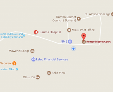
Location and Boundaries
Rombo District Council is one of six administrative Districts in Kilimanjaro region with the area of 1,442 km2 (144,000 Ha), bordered by The Republic of Kenya to the North East, Moshi District to the South, Siha and Longido Districts to the North- West. The District lies between latitude 30 17' South of equator at longitudes 370 40' East and was inaugurated in 1972.
Land usage
44,114 Hectares are suitable for farming, 38,194 Hectares are covered by natural and manmade forests, while 16,692 Ha are potential for raising livestock, while 45,143 Ha. are covered with water bodies, Mount Kilimanjaro, hills, borders and uninhabitable land.
Population
According to the National Census 2012 results the District had a total population of 260,963 people out of which 124,528 were males and 136,435 were females.
Administation
Administratively, Rombo District Council is divided into five (5) divisions, twenty eight (28) Wards and seventy one (71) villages. The District Council has 38 Councilors including one Honorable Member of the Parliament.
Weather
The District has 3 ecological zones, namely Highlands, Middle and the Lowlands. The highlands zone, lies between 1,000m -1,800m above the sea level. The middle zone lies between 900m- 1,000m above the sea level, having clay to loamy soils. Temperatures range from 200-300 C, where most drought resistant crops are grown.
Economic Activities
About 90% of Rombo District residents are involved in agriculture and livestock, 7 percent are entrepreneurs and 3 percent are employees in various public and private sectors. The output of the Rombo District citizen is Tshs 850,000 / per annum according to the population census and 2012 housing.

Rombo District Council,Mkuu Bomani Street
Sanduku la Posta: P.o Box 52,Mkuu,Rombo
simu: 027-2757101
Mobile: 027-2757101
staff mail: ded@rombodc.go.tz
Copyright@2019Rombodc.all rights reserved